Residents share local context
People can contribute a Safe or Hazards place pin or a useful local tip, adding lived experience to the information available to others.
Community safety intelligence
Neighbourhood Watch for this millennium: residents can report hazards—from a tree blocking a road to a local safety concern—while WanderSafe Assist helps authorized city teams review local intelligence and send geo-fenced alerts to the areas that need them. JENI adds explainable context, helping communities stay informed without making surveillance the price of participation.
For councils, community-safety leaders, and trusted local partners.
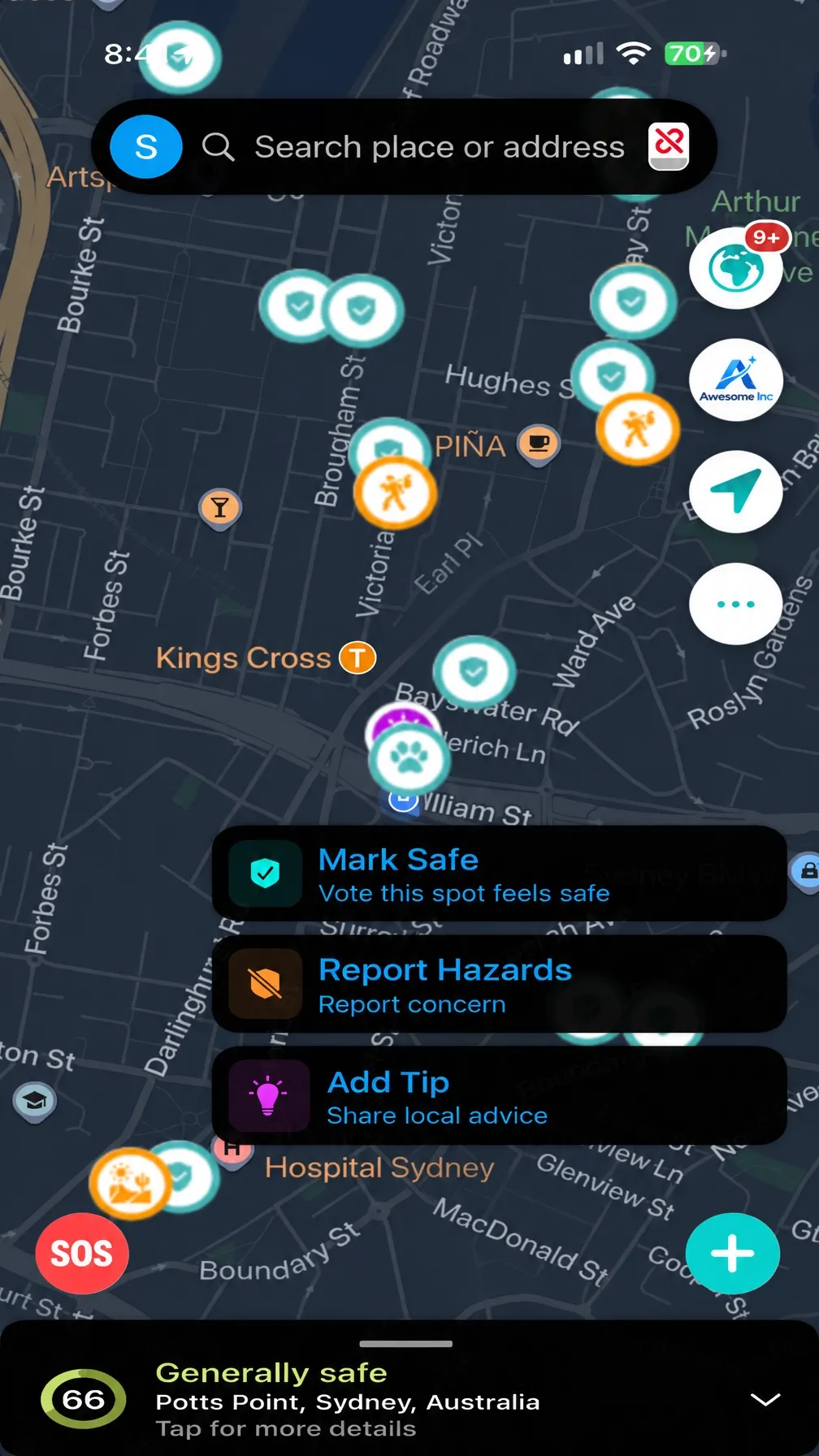
From resident insight to local awareness
Residents can contribute place-based information through Safe or Hazards pins and practical local tips. JENI helps app users consider local context when planning a route. Shared reports are community-provided, not verified emergency alerts or guaranteed safety assessments.
People can contribute a Safe or Hazards place pin or a useful local tip, adding lived experience to the information available to others.
JENI provides real-time safety ratings to help users consider safer routes.
WanderSafe Assist helps authorized teams review local intelligence, report hazards and safety matters, and send geo-fenced alerts to the areas that need them.
Tools for safer, more resilient places
Give city leaders and trusted partners a clearer, privacy-conscious picture of what residents are reporting and where support may be needed.
Review anonymised, neighbourhood-level trends shaped by location, recency, and corroboration.
Use community signals alongside official information to help inform lighting, outreach, transport support, and other local services.
Make trusted support locations and essential services easier to find, including shelters, medical care, water, food, and charging.
WanderSafe Assist lets authorized teams send relevant alerts to a defined geographic area, alongside verified warnings, safe routes, and support information.
Protection without surveillance
Privacy and accountable human oversight are central to the Community approach.
For local government and community partners
Start with one neighbourhood, town centre, transport corridor, or emergency-readiness use case. Together, we can define the safety question, participation model, governance controls, and outcomes to measure.